
Leveraging Stablegen Drones in East Africa: Reliable Drones for Mapping
- Stablegen Investment Ltd
- Dec 15, 2025
- 4 min read
Drones have transformed how we collect data and manage land in East Africa. I see a growing need for reliable drones for mapping. These tools help with agriculture, infrastructure, and environmental monitoring. Using drones cuts costs and saves time compared to traditional methods. Stablegen Drones Academy leads the way in providing drone solutions in Kenya. Their focus on training, sales, and services makes them a key player in the region.
Why Reliable Drones for Mapping Matter
Mapping requires precision and accuracy. Unreliable drones can cause errors that lead to poor decisions. I recommend using drones with stable flight, good sensors, and easy-to-use software. These features ensure data quality and reduce the need for rework.
For example, farmers use drone maps to monitor crop health. Accurate maps help identify pest infestations early. This allows timely intervention and better yields. Similarly, construction companies rely on drone maps to track progress and plan resources. Reliable drones reduce delays and cost overruns.
Governments use drone mapping for urban planning and disaster management. High-quality maps support better infrastructure development and emergency response. This shows the broad impact of reliable drones for mapping across sectors.

How Stablegen Drones Academy Supports Mapping Needs
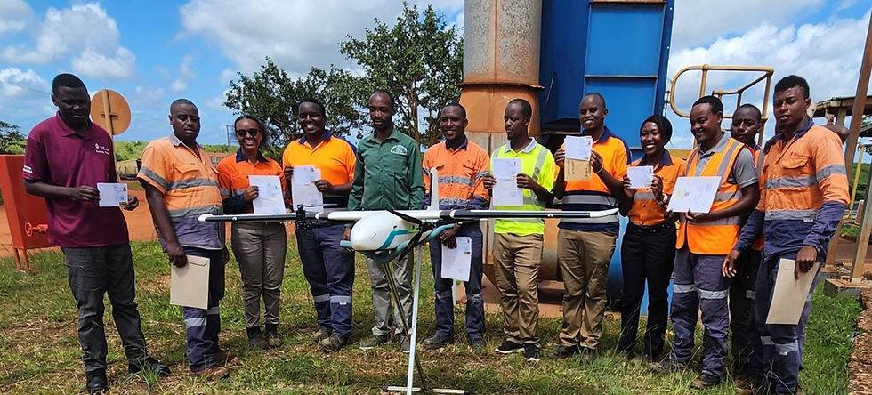
Stablegen Drones Academy offers comprehensive drone pilot training. They teach practical skills for flying and data collection. This training ensures pilots can operate drones safely and efficiently. They also provide registered drones that meet Kenya’s aviation standards.
The academy offers specialized services like surveillance and mapping. Their expertise helps businesses and government entities get accurate data. They use advanced drones equipped with GPS and high-resolution cameras. This technology delivers detailed maps for various applications.
I find their approach practical. They combine training, sales, and services to cover all client needs. This makes them a one-stop solution for drone mapping in Kenya and beyond.
Practical Applications of Drone Mapping in East Africa
Drone mapping has many uses in East Africa. Here are some key examples:
Agriculture
Drones monitor crop health, soil conditions, and irrigation. This data helps farmers optimize inputs and increase yields.
Infrastructure Development
Drones survey construction sites and monitor progress. They provide real-time data to project managers.
Environmental Monitoring
Drones track deforestation, wildlife, and water resources. This supports conservation efforts and policy making.
Disaster Management
Drones map flood zones and damaged areas. This information aids rescue and recovery operations.
Land Surveying
Drones create accurate topographic maps for land registration and planning.
These applications show how drone mapping improves efficiency and decision-making. Using reliable drones is critical to achieving these benefits.

Choosing the Right Drone for Mapping
Selecting the right drone depends on your specific needs. Here are factors to consider:
Flight Stability: Look for drones with GPS and auto-hover features. This ensures steady flight and accurate data capture.
Camera Quality: High-resolution cameras provide detailed images. Multispectral or thermal cameras add value for agriculture and inspection.
Battery Life: Longer flight times cover larger areas without interruption.
Ease of Use: User-friendly controls and software reduce training time.
Regulatory Compliance: Ensure the drone is registered and meets local aviation rules.
I recommend consulting experts like Stablegen Drones Academy. They can guide you to the best drone model for your mapping projects.
Expanding Drone Use with Stablegen Drones East
The demand for drone services grows rapidly in East Africa. I see opportunities for businesses and government agencies to adopt drone technology. The stablegen drones east platform supports this growth by offering reliable drones and expert training.
By leveraging their services, users gain access to cutting-edge technology and local expertise. This helps overcome challenges like limited infrastructure and regulatory hurdles. Stablegen’s focus on quality and compliance builds trust in drone solutions.
I encourage anyone interested in drone mapping to explore what Stablegen offers. Their integrated approach makes drone adoption easier and more effective.
Building Skills for the Future
Drone technology evolves fast. Continuous learning is essential to stay current. Stablegen Drones Academy provides ongoing training and certification. This helps pilots improve skills and adapt to new tools.
I advise investing in training to maximize drone benefits. Skilled pilots reduce risks and improve data quality. Training also covers safety and legal requirements, which are crucial for responsible drone use.
Developing local expertise supports the growth of the drone industry in East Africa. It creates jobs and drives innovation. This aligns with the goal of making Kenya a regional leader in drone technology.
Final Thoughts on Drone Mapping in East Africa
Reliable drones for mapping are transforming many sectors in East Africa. They provide accurate data that supports better decisions and efficient operations. Stablegen Drones Academy plays a vital role by offering training, sales, and services tailored to local needs.
Adopting drone technology requires careful planning and the right partners. I recommend focusing on quality equipment, pilot skills, and regulatory compliance. This approach ensures successful drone projects and long-term benefits.
The future of drone mapping in East Africa looks promising. With the right tools and expertise, we can unlock new opportunities for growth and development.


Comments